VITO converts satellite images into usable maps that give farmers insight into the condition of their fields. This enables farmers to better manage their crops and make informed, sustainable decisions.
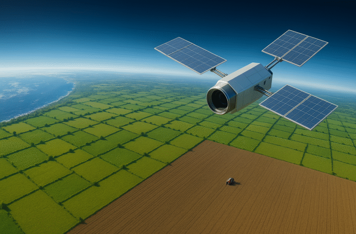
The Flemish Institute for Technological Research (VITO) has been conducting Earth observations using satellites for several years. These satellites transmit images to VITO’s data center in Mol every three to five days. There, the images are processed and made available to farmers via the online platform WatchITgrow. This tool provides farmers with insights into their fields so they can cultivate them in a sustainable way.
Our editorial team took a unique behind-the-scenes look at the data center in Mol. How is the data collected and transformed into valuable maps for farmers?
From Satellite to Field
VITO participates in the European Copernicus project, which continuously collects data about our planet via Sentinel satellites. “The Sentinel-1 and Sentinel-2 satellites are specifically designed for vegetation and agriculture, and we use them for the WatchITgrow platform,” explains Jürgen Decloedt, Business Development at VITO Remote Sensing.
“The data captured by these satellites arrives here at the data center in Mol via a high-speed connection. In practice, these are raw images that cannot yet be analyzed.” This raw data must first be checked and processed by a VITO expert before appearing as usable maps on the platform.
The satellites send data to our data center in Mol every 3 to 5 days.
Jürgen Decloedt, Business Development at VITO Remote Sensing
Decloedt shows us an example of a processed map. The maps have a resolution of approximately ten meters. “That may not seem like much, but it’s sufficiently accurate for our agricultural application,” he explains. The maps are reminiscent of Google Maps, although Decloedt points out that Google uses commercial satellites with higher resolution. “That naturally comes with a higher cost, but we don’t need that resolution for our agricultural application,” he adds.
Moreover, the satellite images are open source: anyone can access them via Terrascope.be.
Data Center in Mol
Decloedt guides us further to the Remote Sensing department’s data center and leaves us in the capable hands of Yves Verheijen, who helped build the data center and currently maintains it. In this room, all satellite data is received.
We immediately notice the cold air flowing under our feet. “That’s the hot aisle/cold aisle principle,” explains Verheijen. “The floor is raised so cold air can circulate under the machines and cool them directly, which is an efficient method to cool the entire hall.”


The data center is divided into three rooms. Two of them are dedicated to processing (GPU and CPU), where Terrascope, cropSAR, and WatchITgrow run, among others. The third room serves for data storage of all images and provides nine petabytes of storage space.
The data therefore travels quite a journey: from satellite to data center, to a VITO expert, and finally to the farmer.
WatchITgrow
The final destination of the processed images is the online platform WatchITgrow, where farmers come into contact with the technology. Nearly 650 farmers now use the free platform designed by VITO. When a farmer registers (anyone can do this, by the way), they get an overview with all maps of their registered plots.
Various data sources come together there: in addition to satellite images, weather and soil data are also integrated, and farmers can enter additional information themselves. This creates a digital twin of their plots where crop performance is accurately monitored.

Farmers receive maps about greenness index, soil erosion, and water stress, among other things, which help them better time irrigation, fertilization, and harvest. Decloedt explains this with an example: “Specifically, farmers can choose whether to give extra fertilizer to the stronger, green zones to maximize their potential, or apply more fertilizer to the weaker, less green zones to improve them,” Decloedt explains.
With this information, farmers can accurately monitor their crops and make more sustainable decisions that benefit both yield and the environment.
Looking through the Clouds
Satellites orbit the Earth and take images above the clouds. On a (common) cloudy day in Belgium, the images are covered with white spots (clouds) making the ground underneath invisible. VITO has designed a system for this called ‘CropSAR’.
“The solution uses SAR or radar satellites and AI models to look through the clouds,” says Decloedt. “The radar satellite sends a signal to Earth and measures the height and structure of the Earth’s surface at millimeter level.”
We have developed a system to look through the clouds.
Jürgen Decloedt, Business Development at VITO Remote Sensing
This doesn’t yield visual data but complex and large amounts of metadata. “We have trained an AI model to find correlations between SAR data and optical data. On cloudy days we use synthetic images based on SAR data, on clear days the optical data.”

The system also continuously learns about the relationship between SAR and optical data. “VITO has been doing this since 2018, so we now have sufficient confidence in the synthetic images we create,” says Decloedt.
The Modern Farmer
Although we don’t immediately associate IT with farmers, it’s indispensable nowadays. Farmers increasingly need to become data scientists. Not only to support their sustainability efforts, but also in terms of future regulations.
With WatchITgrow, farmers can already collect data, such as fertilization or crop protection, which can later automatically serve to comply with future regulations.
“With WatchITgrow, we want to make all data, knowledge, and insights we derive from research available to farmers to support them in their sustainability efforts and create an impact on the agricultural sector,” Decloedt concludes.